
VT Publishing and Virginia Tech Libraries are excited to share a new Digital Humanities project, Redlining Virginia. The project is based on a physical exhibit that was held in the Newman Library at Virginia Tech from December 7, 2016 to February 17, 2017 and is part of a larger project, Mapping Inequality, a collaboration of three teams at four universities, including the University of Richmond, the University of Maryland, Johns Hopkins University, and Virginia Tech.
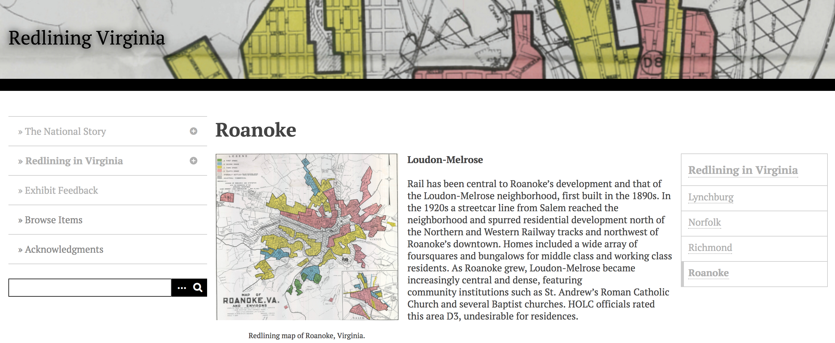
Mapping Inequality provides access to a collection of “security maps” and descriptions created by the Home Owners’ Loan Corporation (HOLC) between 1935 and 1940. These maps and their corresponding descriptions used a color-coding system to assign risk levels to different areas within a city which were often based on racial lines. As a result, they changed the course of real-estate practice for over a century.
Redlining Virginia was created using Omeka by LaDale Winling, in the History Department, with Eleanor Boggs and Nicholas Bolin. It pulls together HOLC maps from popular areas in Virginia to show the impact on Virginia Cities over time.
For more information on Mapping Inequality, please see this VT News Story.